Request Consultation
+91 73058 87605 mail@addpower.in

Mon – Sat : 9.30 AM – 6.30 PM


Engineering Solution

GIS Mapping & Data Analysis

Advanced Geographic Information System (GIS) solutions for asset mapping, infrastructure planning, spatial intelligence, and engineering decision-making.

GIS mapping and data analysis by Admire Power Engineering

Solution Overview

Spatial Intelligence for Smarter Infrastructure

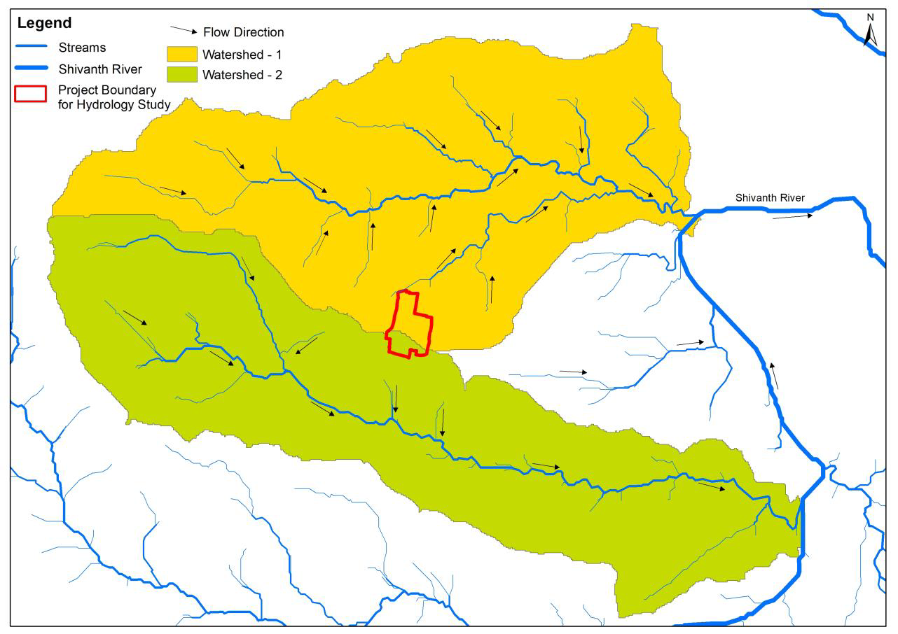
Admire Power Engineering builds accurate, GIS-ready asset and infrastructure maps that turn scattered field data into a single, reliable source of spatial intelligence — supporting planning, operations and engineering decisions.

  • GIS Mapping
  • Asset Digitization
  • Utility Mapping
  • Spatial Analysis
  • Infrastructure Planning
  • Decision Support

Business Challenges

The Challenges We Help You Overcome

Without reliable spatial data, infrastructure decisions become slow, costly and error-prone. Here are the problems our GIS solutions solve.

Poor Asset Visibility

Little clarity on where assets are, their condition or their relationships across the site.

Scattered Infrastructure Data

Asset records, drawings and field notes held separately with no single spatial picture.

Manual Mapping

Time-consuming paper maps and manual drafting that quickly become outdated.

Planning Difficulties

Expansion and maintenance planning slowed by missing, incomplete or inconsistent maps.

Data Duplication

The same asset recorded many times in different systems, creating conflicting records.

Lack of Spatial Intelligence

No analytical insight from data that could drive better engineering decisions.

Our Solution

Complete GIS Mapping & Analysis Capability

Integrated GIS services that transform field and asset data into accurate, actionable spatial deliverables for engineering teams.

GIS Database Creation

Structured spatial databases built to consistent standards, schemas and coordinate systems.

Digital Asset Mapping

Accurate digital mapping of assets, equipment and infrastructure for complete visibility.

Spatial Data Analysis

Analytical GIS models that reveal patterns, relationships and insights across your data.

Infrastructure Mapping

Layered mapping of power, water, roads and utilities for integrated infrastructure planning.

Decision Support

GIS outputs that give management and engineering teams a reliable basis for decisions.

Custom GIS Reports

Tailored maps, charts and reports delivered in the formats your organisation needs.

Technology & Methodology

The Tools Behind Accurate Spatial Data

A disciplined blend of survey technology, GIS software and validation methods ensures every deliverable is accurate and dependable.

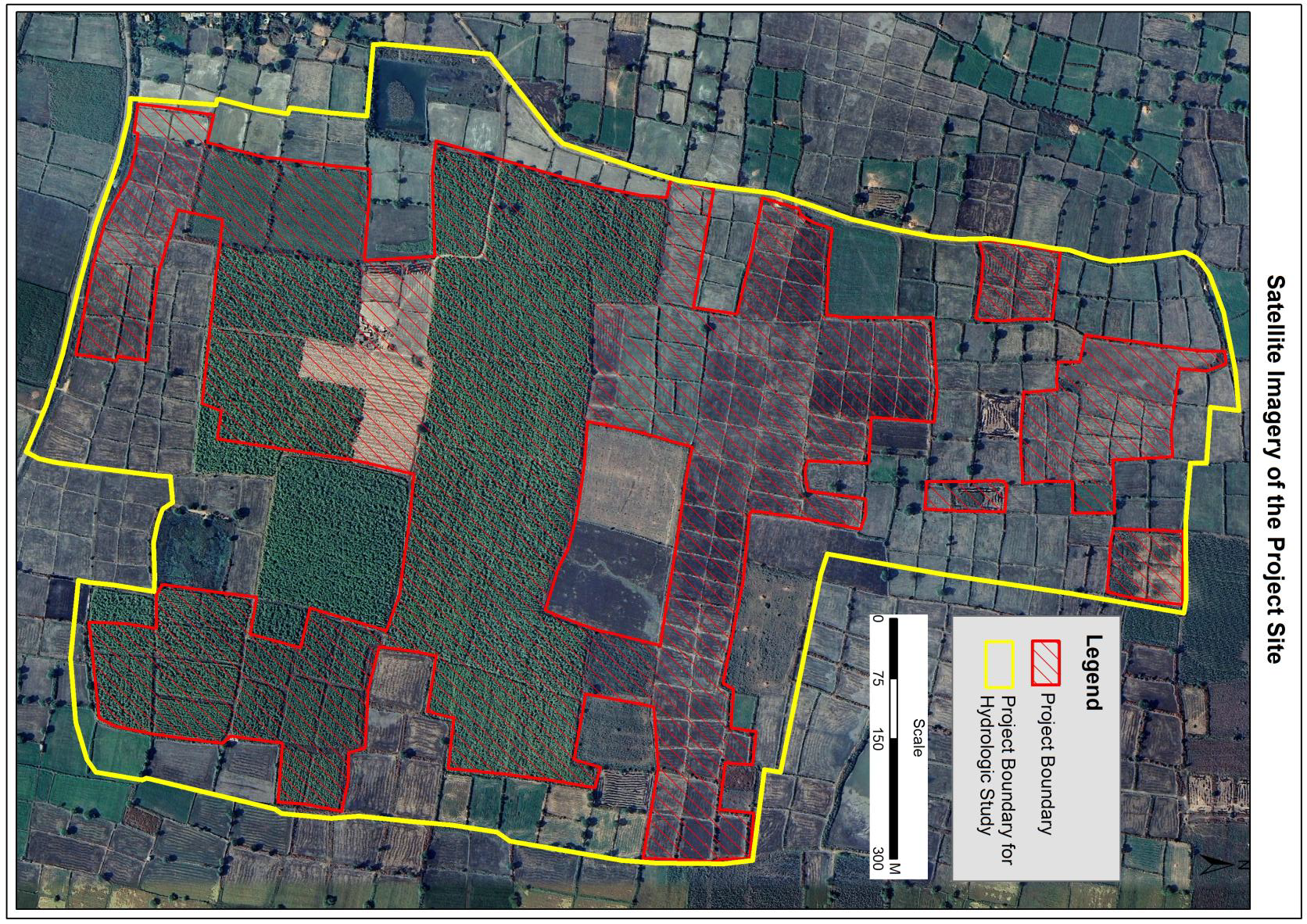
Satellite Imagery

High-resolution satellite imagery as base reference for wide-area mapping and analysis.

GPS Survey

Precise GPS field surveys that anchor spatial data to real-world coordinates.

GIS Software

Industry-standard GIS platforms for mapping, analysis, layering and visualisation.

Spatial Database

Robust spatial databases that store, query and serve large volumes of location data.

Data Validation

Systematic checks against field surveys and reference data to confirm accuracy.

Engineering Analysis

Engineering review of spatial outputs to support design, planning and compliance.

Applications

Where Our GIS Solutions Apply

GIS mapping and analysis delivers value across power, energy, industry, government and infrastructure sectors.

GIS mapping for power distribution networks

Power Distribution

Spatial mapping of distribution assets, feeders and service areas.

GIS mapping for solar parks

Solar Parks

GIS layers for array layout, land parcels and evacuation planning.

GIS mapping for industrial plants

Industrial Plants

Complete asset and utility mapping for plant operations.

GIS mapping for government projects

Government Projects

GIS deliverables for public works, planning and administration.

GIS mapping for utility networks

Utility Networks

Mapping of electricity, water and communication utility networks.

GIS mapping for infrastructure development

Infrastructure Development

Spatial intelligence for planning and developing new infrastructure.

Benefits

What Your Organisation Gains

Reliable spatial data translates into better decisions, faster execution and lower operational cost.

Improved Planning

Accurate spatial baselines support confident infrastructure and expansion planning.

Accurate Asset Tracking

Every asset mapped precisely and documented in a single reliable database.

Reduced Survey Time

Digital workflows eliminate repeated field visits and manual re-measurement.

Better Decision Making

Spatial analysis gives management a clear, evidence-based view of operations.

Lower Operational Cost

Fewer site visits, reduced duplication and smarter maintenance reduce costs.

Future-ready Data

Standardised GIS data ready to support digital twins and future automation.

Why Admire

Why Choose Admire

Engineering strength, modern equipment and dependable delivery on every GIS project.

35+ Years Experience

Three decades of proven engineering and infrastructure project delivery.

Professional Engineering Team

Qualified engineers and GIS specialists on every project.

Modern Survey Equipment

Current GPS, GIS and survey technology for accurate results.

Quality Assurance

Rigorous data validation and quality checks at every stage.

Safety Standards

Strict field safety protocols aligned with industry standards.

Timely Delivery

Disciplined project management with reliable schedules.

How We Work

Project Workflow

A disciplined seven-stage process that takes your GIS project from requirement to delivery.

  1. Requirement

    Scope, standards and data needs defined.

  2. Survey

    Field survey and ground control planning.

  3. Data Collection

    GPS, imagery and asset data captured.

  4. GIS Processing

    Data cleaned, layered and georeferenced.

  5. Analysis

    Spatial analysis and model preparation.

  6. Validation

    Accuracy checks against reference data.

  7. Delivery

    Maps, data and reports handed over.

FAQ

Frequently Asked Questions

Answers to common questions about our GIS Mapping & Data Analysis solution.

We provide GIS mapping for asset digitization, utility networks, infrastructure and land parcels — delivered as accurate, layered spatial data ready for planning and decision-making.

Power distribution, solar parks, industrial plants, government projects and utility networks benefit from our GIS mapping, spatial analysis and decision-support deliverables.

Our GIS data is built from high-accuracy GPS surveys and validated against field and reference data, delivering engineering-grade positional accuracy.

Yes. We deliver GIS data in standard formats and schemas that integrate with your asset management, planning and operations platforms.

Yes. We provide documentation, training and ongoing support so your team can confidently use and maintain the GIS deliverables.